Naredi Fm
Type Locality and Naming
OUTCROP. Named after the village Naredi. [Original Publication: Biswas, S.K. and Raju, D.S.N. (1971) Note on the rock stratigraphic classification of the Tertiary sediments of Kutch Quart. Jour. Geol. Min. Met. Soc. India, vol, pp.]. Reference well: Borehole B/3/4
Synonyms: This rock unit was earlier named variously as “Gypseous Shales” by Wynne 1872, and “Laki Beds” by Tewari, 1957. The brightly colored lateritic argillaceous formations named as the Naredi Formation after its stratotype in the cliffs of the Kakdi Nadi near the village Naredi.
Lithology and Thickness
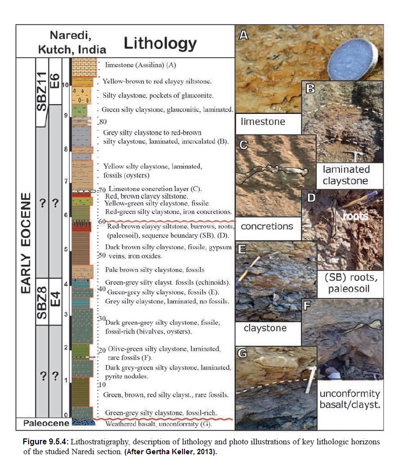
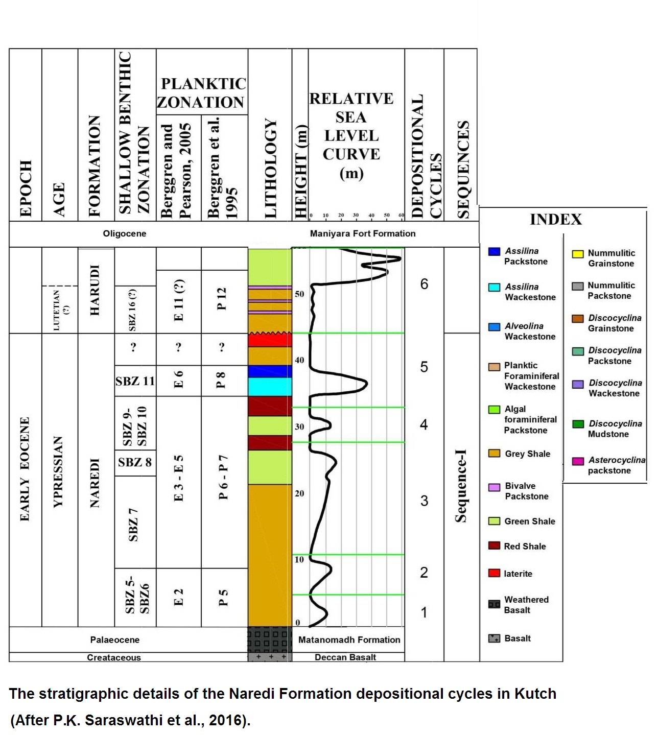
Gypsiferous claystone, Limestone and Paleosols. Refer to Figure 1 for lithology; and Figure 5 (under Depositional Environments) for nine minor cycles of sea-level fluctuations in the type section. Three distinct members are identified:
(i) Gypseous Shale Member: The lowest member is about 24 m thick and consists of grey, brown, glauconitic sandstone and splintery shales with thin layers of gypsum with sideritic concretions and occasionally contains fossils of Nautilus.
(ii) Assilina Limestone Member: it is 6 m thick, and consists of bedded dirty white limestone and alloys grey marlite with Assilina
(iii) Ferruginous Claystone Member: The uppermost member is about 50 m thick, and consists of grey and brown claystone with layers of gypsum and red ferruginous laminae. The lower and middle part locally developed black shale facies, pyretic shales and lignite beds.
[Figure 1: Lithology, description of lithology, photo illustrations of key lithologic horizons of the studied Naredi Section (after Gerta Keller (2013)]
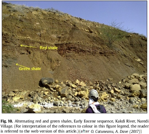
[Figure 2: Alternating red and green shales, Early Eocene sequence, Kakdi River, Naredi Village (after O. Catuneanu, A. Dave (2017)]
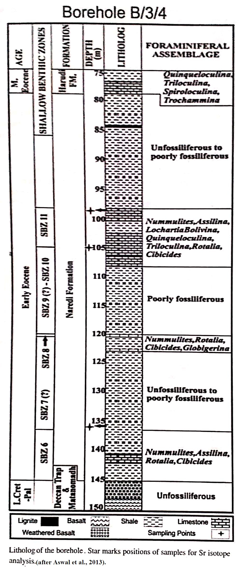
[Figure 3: Litho-log of the borehole, Star marks positions of samples for Sr isotope analysis. (after Anwal et al., 2013)]
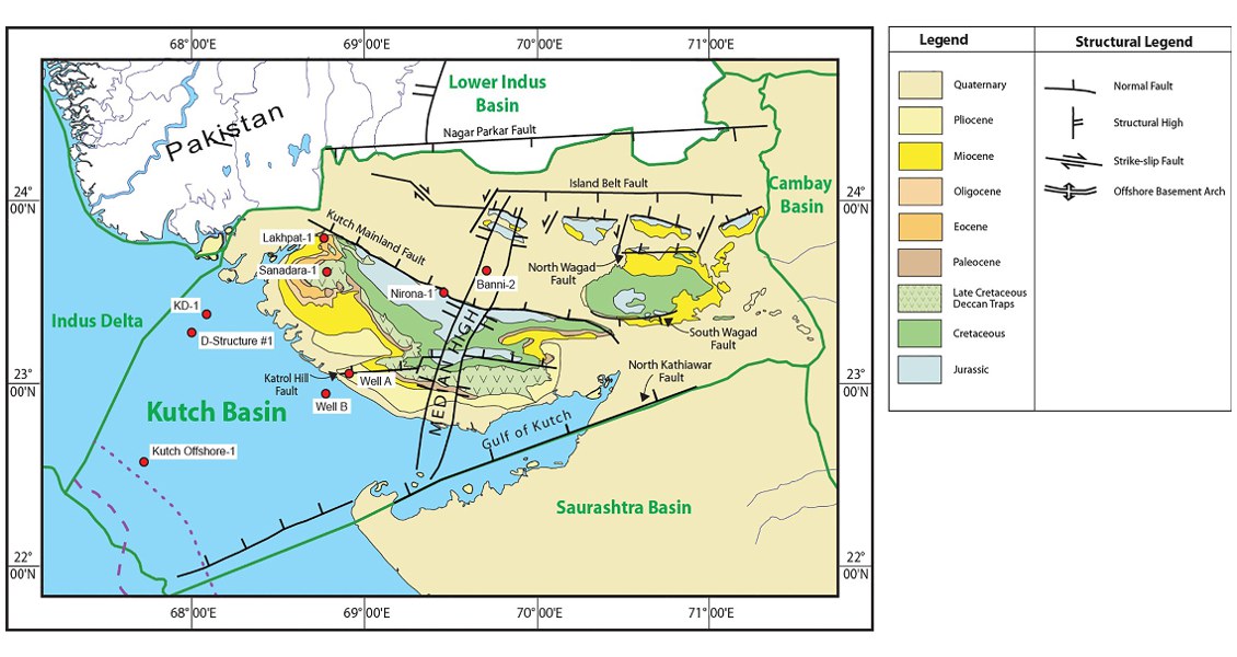
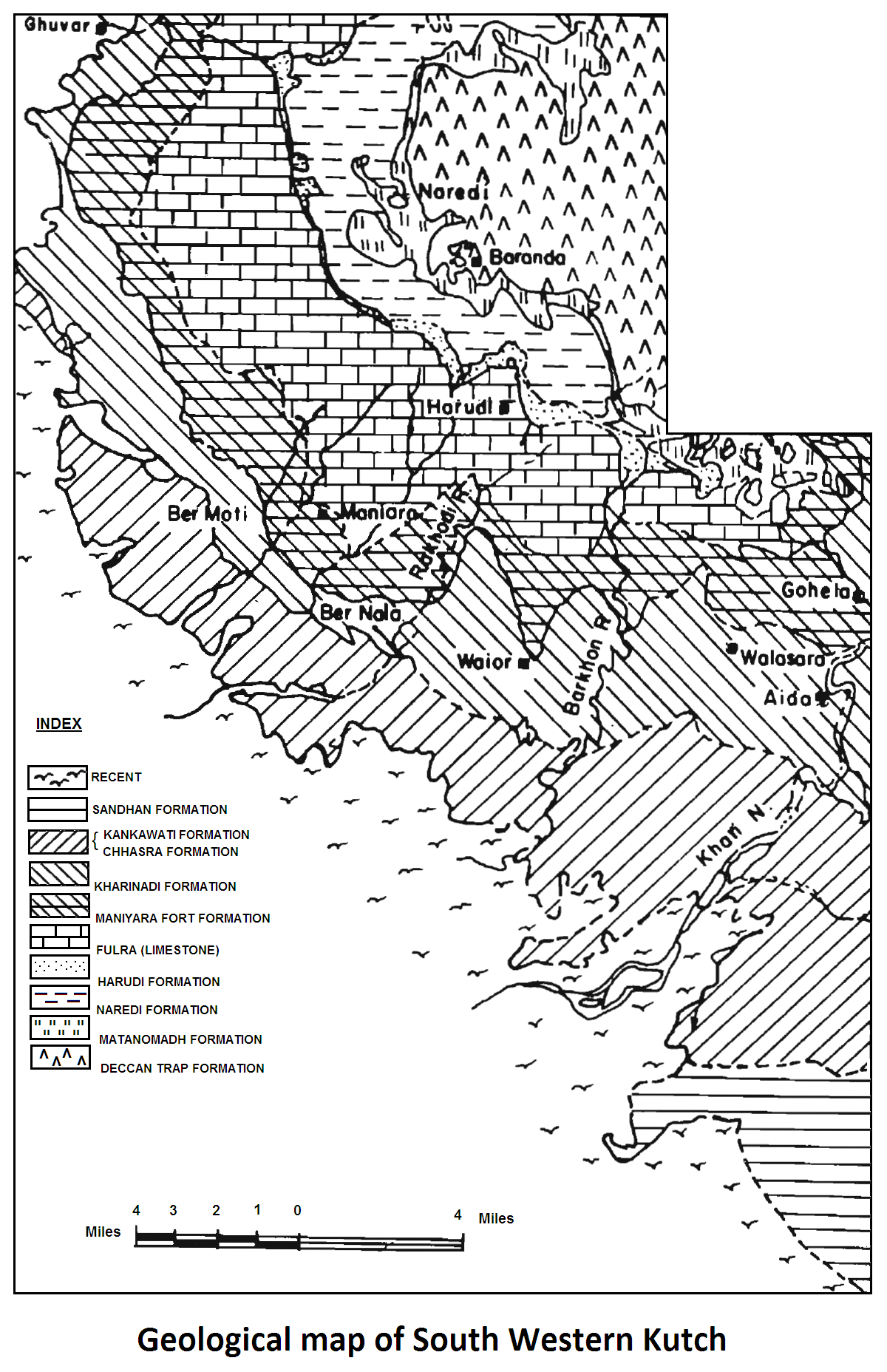
[Figure 4: Geological Map of South Western Kutch (after Biswas and Raju, 1973)]
Relationships and Distribution
Lower contact
Lower boundary sharply defined by red laterite or trap-pebbles conglomerate above Deccan Traps Fm. It is a major hiatus and exposure surface. In the borehole section, a hiatus of 7 Myr is estimated between the Deccan Traps Fm basalt (69 Ma to 63 Ma; Pande, 2002) and the overlying sediments of the Naredi Fm (SBZ5).
Upper contact
Disconformably overlain by the Harudi Fm with exposure-soils. The upper boundary is marked by lignite bands in the type locality, elsewhere the contact is disconformable with a laterite bed. It is estimated on missing biostratigraphic zones that hiatus of ~7 Myr (extending from SBZ12 to SBZ15) exists between the Naredi Fm and Harudi Fm.
Regional extent
GeoJSON
Fossils
Nummulites globules nanni, N. burdigalensis, Assilina spinosa (Raju and Misra, 2009).
Age
Depositional setting
Sarnavan, Bajpai and Raju (2008) recognized nine minor cycles of sea-level fluctuations in type section. The paleobathymetry ranges from non-marine to 45 m.
[Figure 5: Stratigraphic details of the Naredi Formation depositional cycles in Kutch (after P.K. Saraswathi et al., 2016)]
Additional Information
